Climbing in the Schweizerland Mountains
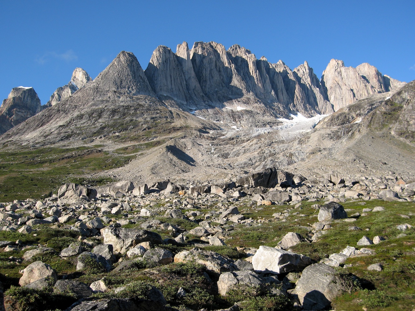
The Fox Jaw Cirque in the Schweizerland Mountains of East Greenland is named as such because of the rows of jagged teeth-like rock towers, with dental-esque names to match. Although an obvious lure for climbers, the Fox Jaw Cirque is in a pretty remote part of the world so had only seen it's first climbers in 1998, and since then only a few routes had been established. However, the Schweizerland Mountains are extensive and the Fox Jaw Cirque is just a small part, so we aimed to spend the first half of the trip higher up in the mountains exploring new terrain around the Kaarali Glacier, and the other half in the Tasiilap Kuua Valley climbing at the Fox Jaw. So with just enough information to know that it was worth a climbing trip, but not enough known to detract from the exploratory nature and new route potential, we set off to spend six weeks climbing over July/August 2006.
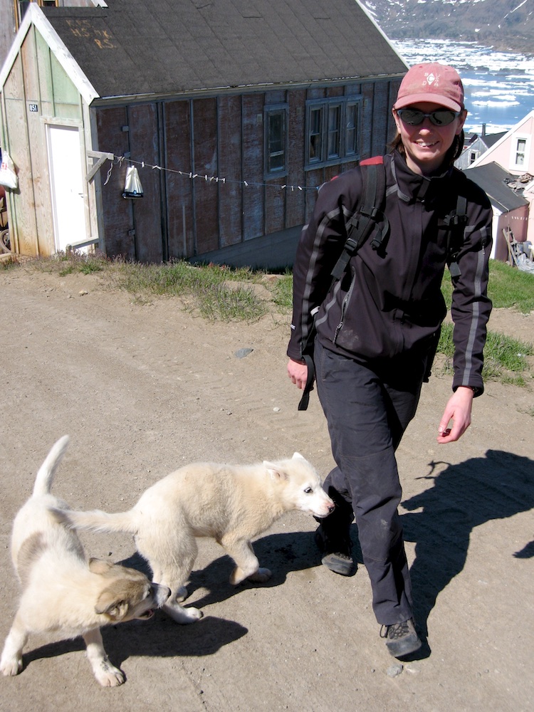
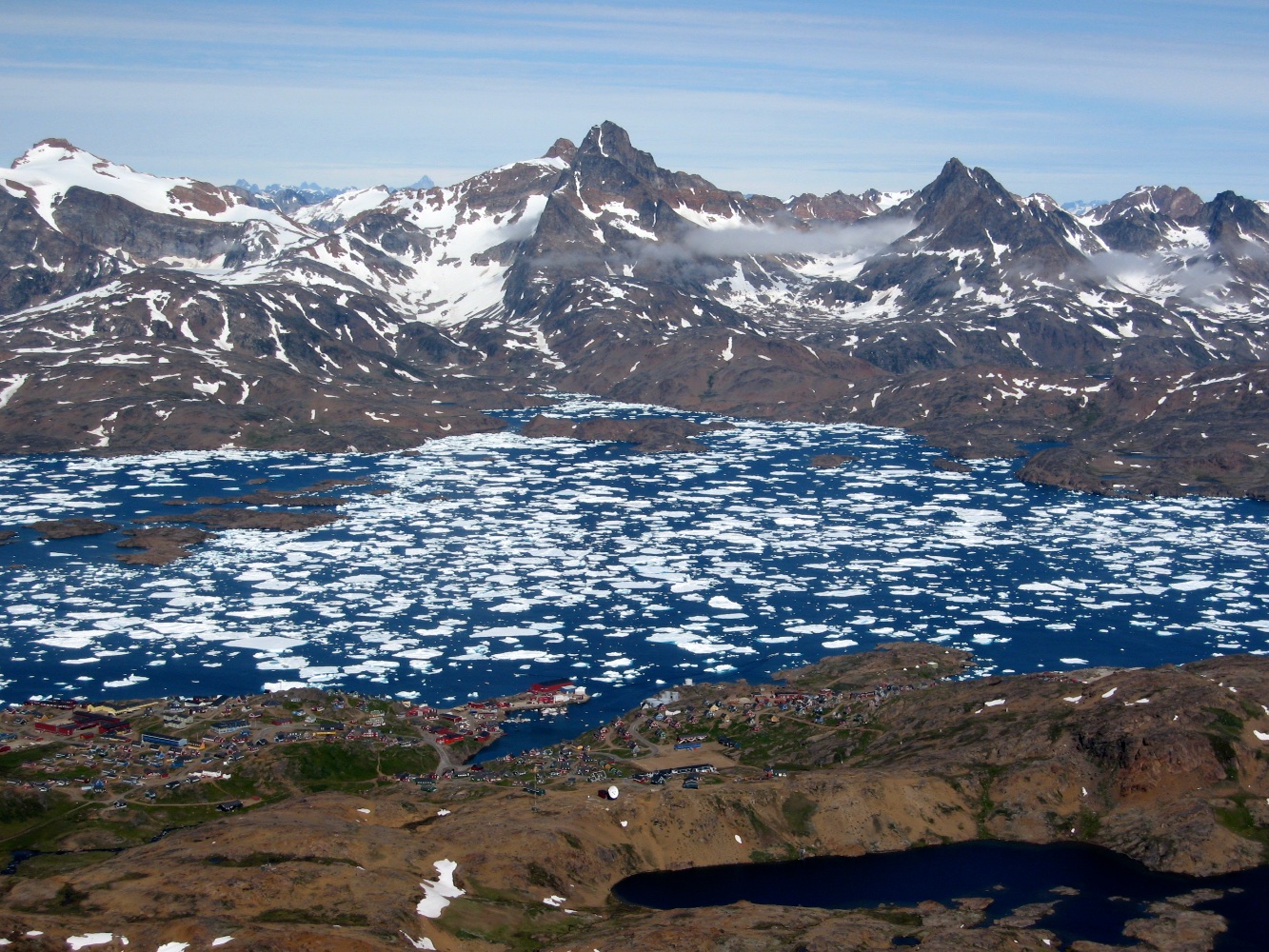
The town of Tasiilaq with it's colourful houses
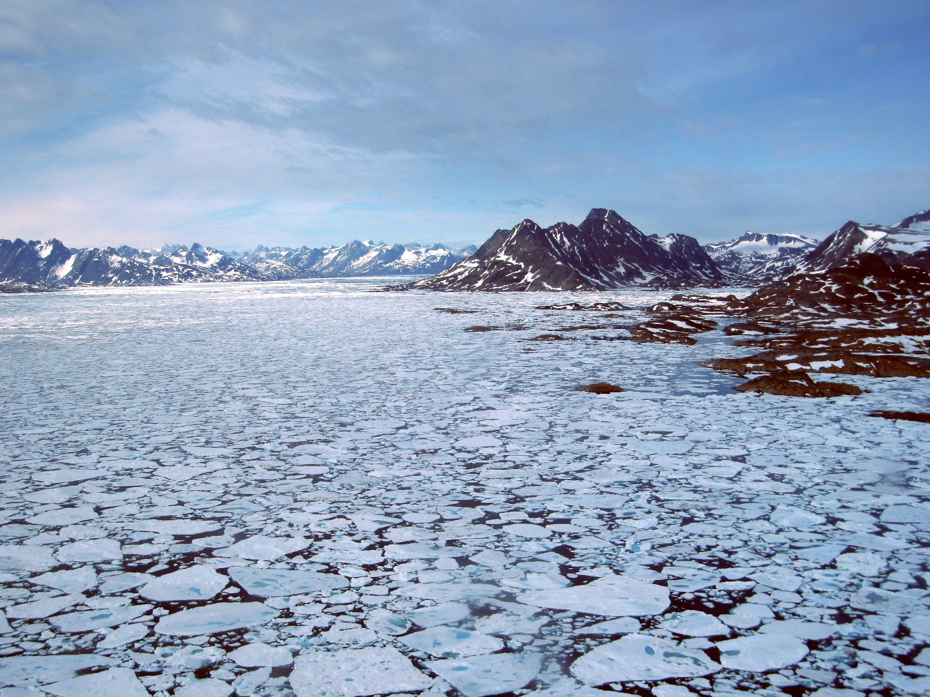
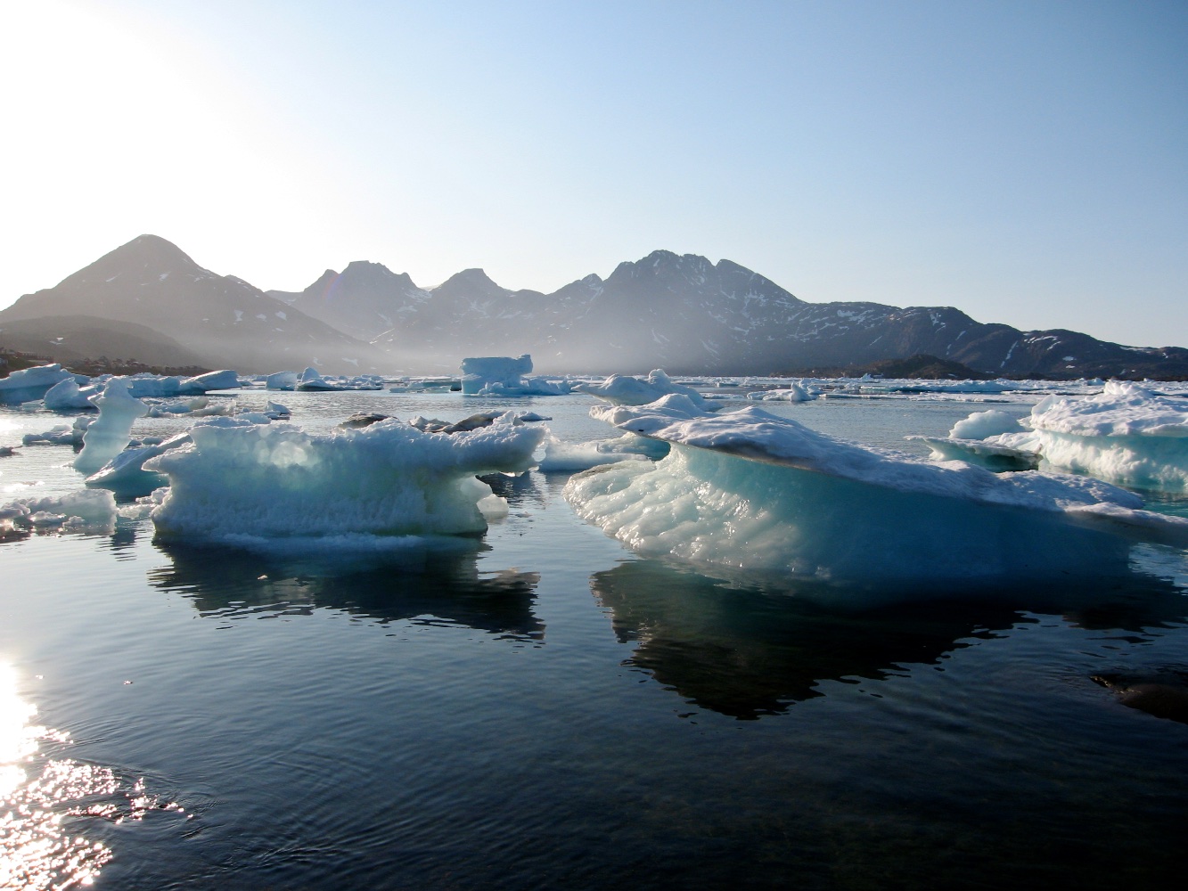
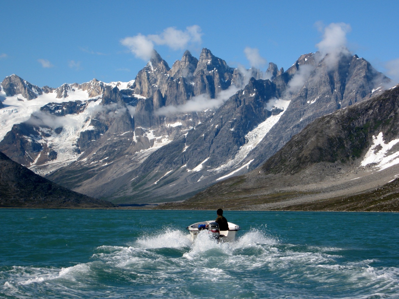
Via Europe, then Iceland, we flew to the island of Kulusuk in Greenland. As there was too much sea ice for boat travel to the nearby town of Tasiilaq, we took a spectacular helicopter flight there, awed by the expanse of sea ice and surrounding rugged, barren landscape. After organising final things in Tasiilaq we had a failed attempt to get to the climbing area by boat. The tin dingy wound and nudged its way through the maze of ‘bergy bits’ and ‘growlers’ with a commendable effort considering its size, but the driver eventually had to admit defeat and turn back to Tasiilaq. So another helicopter ride took us to the fishing village of Kuummiiut which is about 45km from Tasiilaq and further up the Angmagssalik Fjord where less ice blows in. From there we could get a fisherman to take us to end of the Angmagssalik Fjord and beyond to the head of the Tasiilaq Fjord.
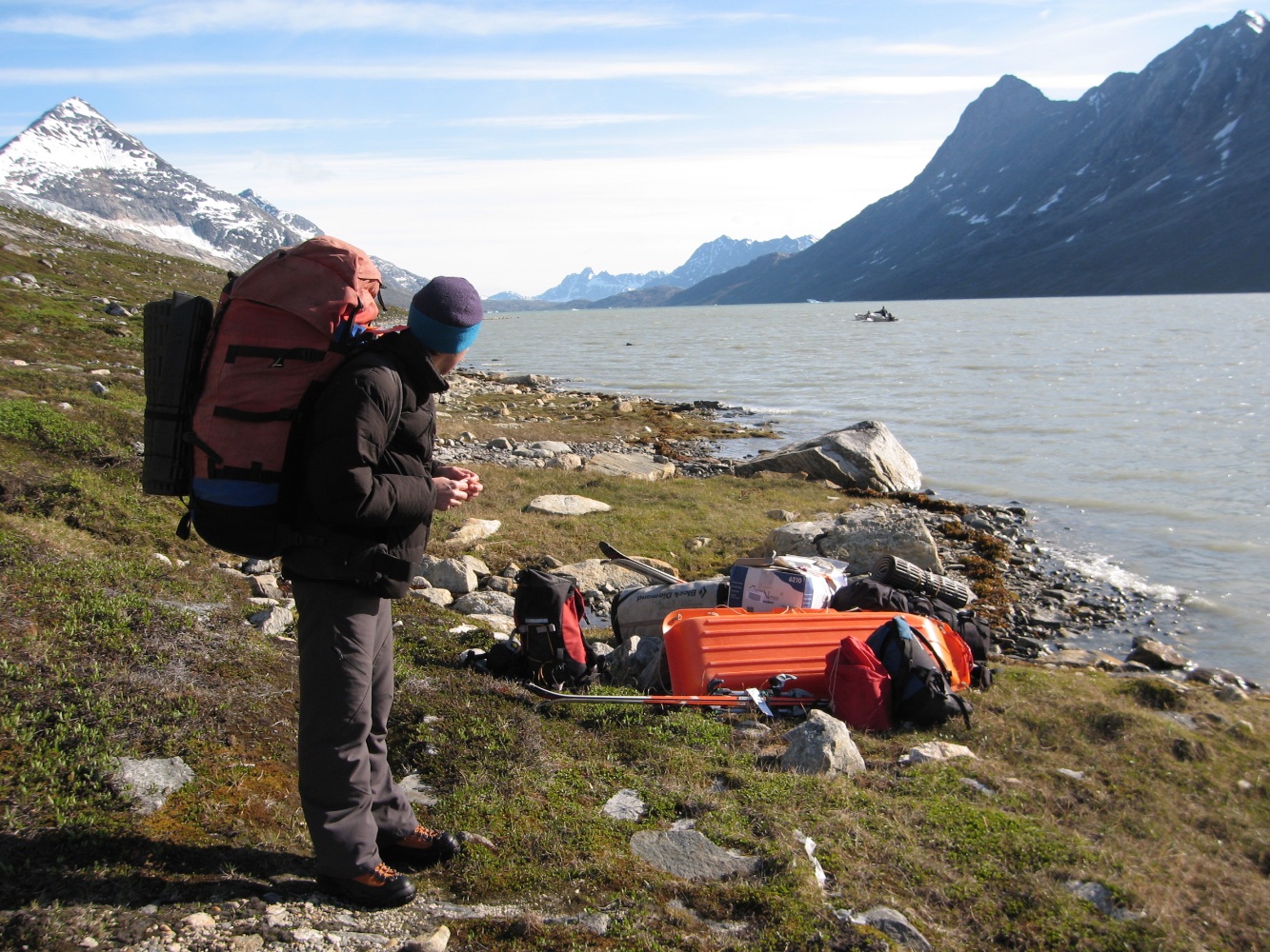
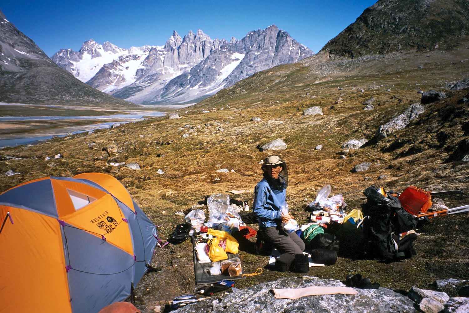
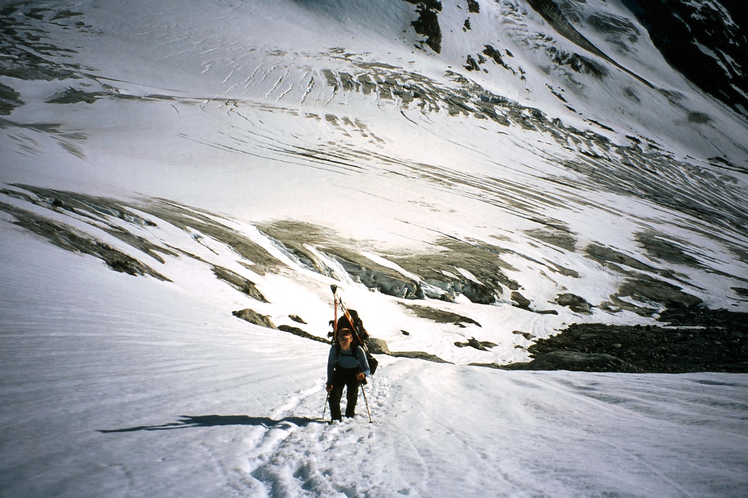
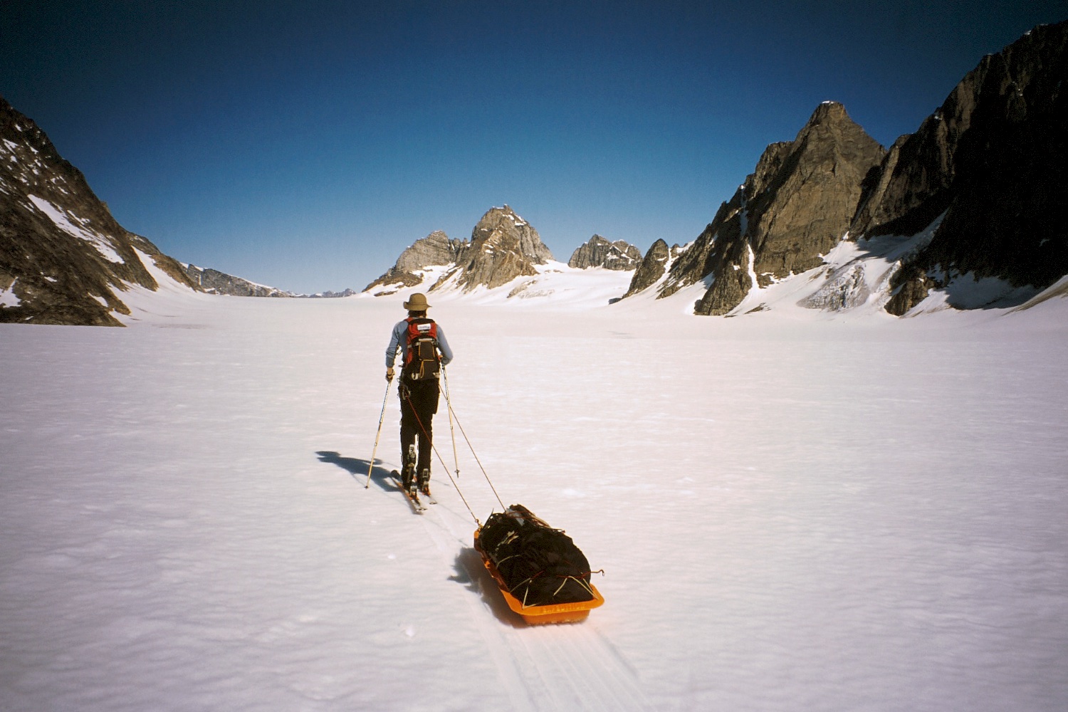
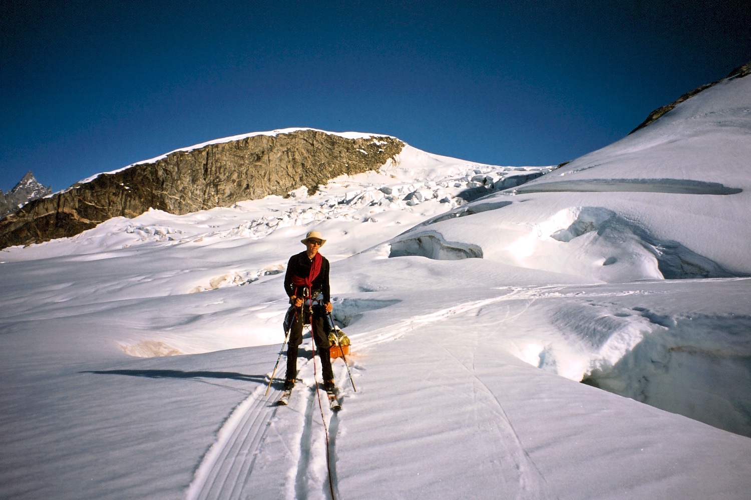
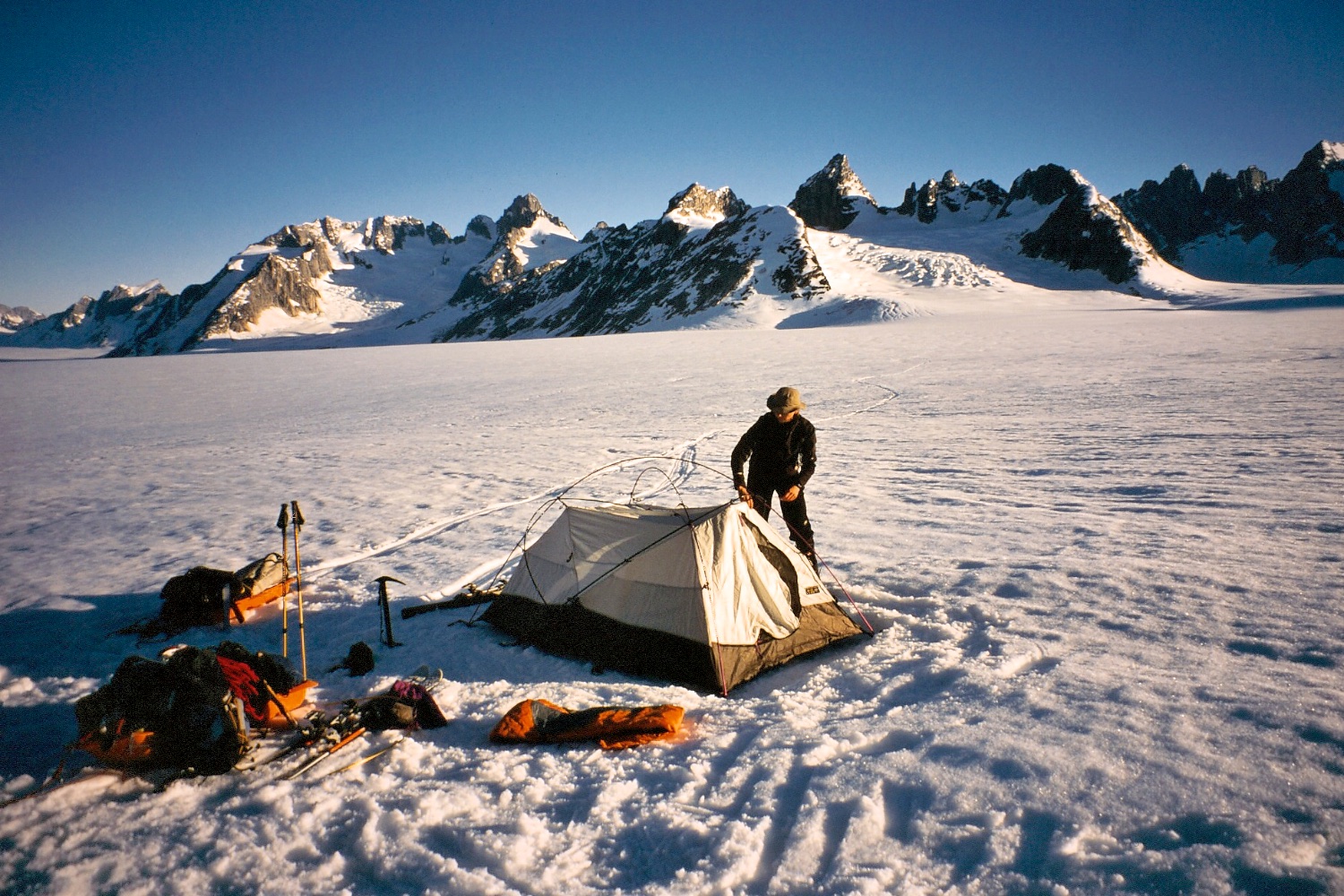
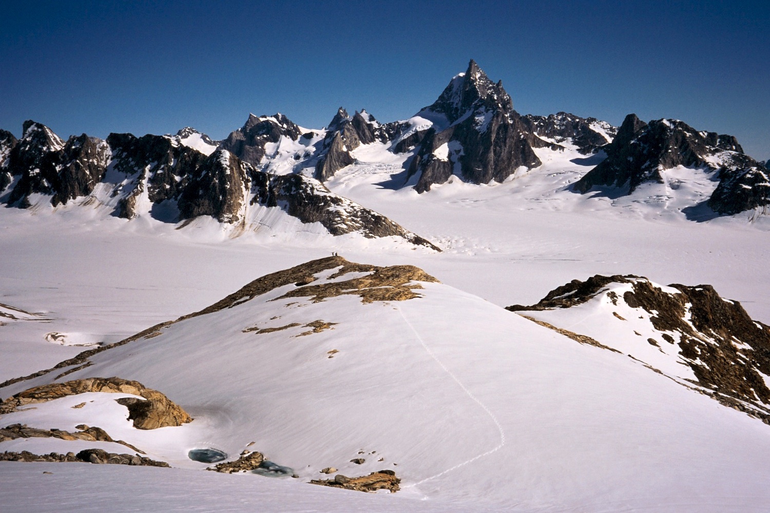
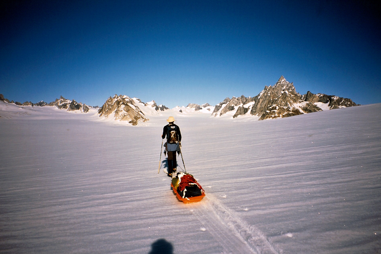
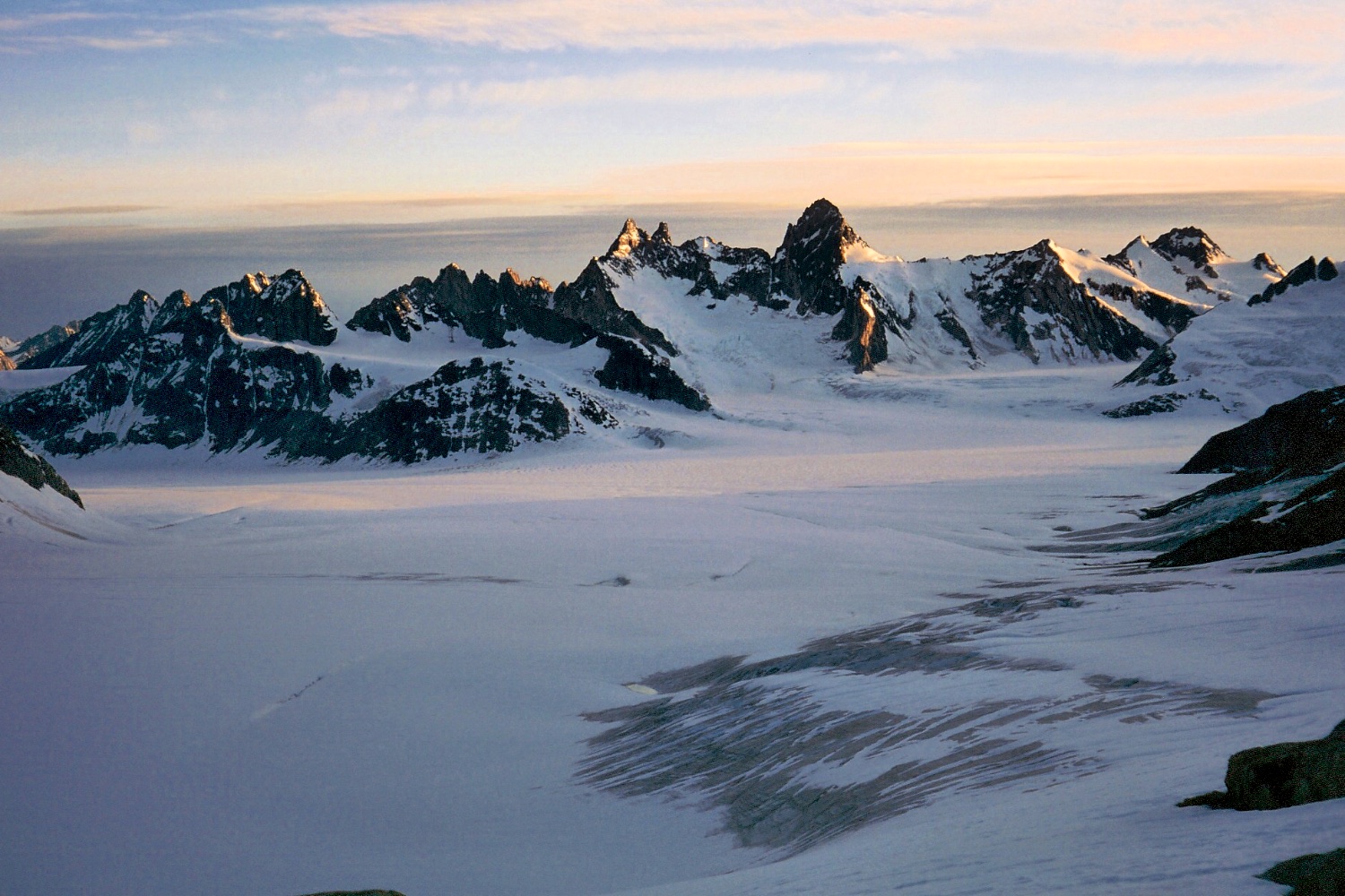
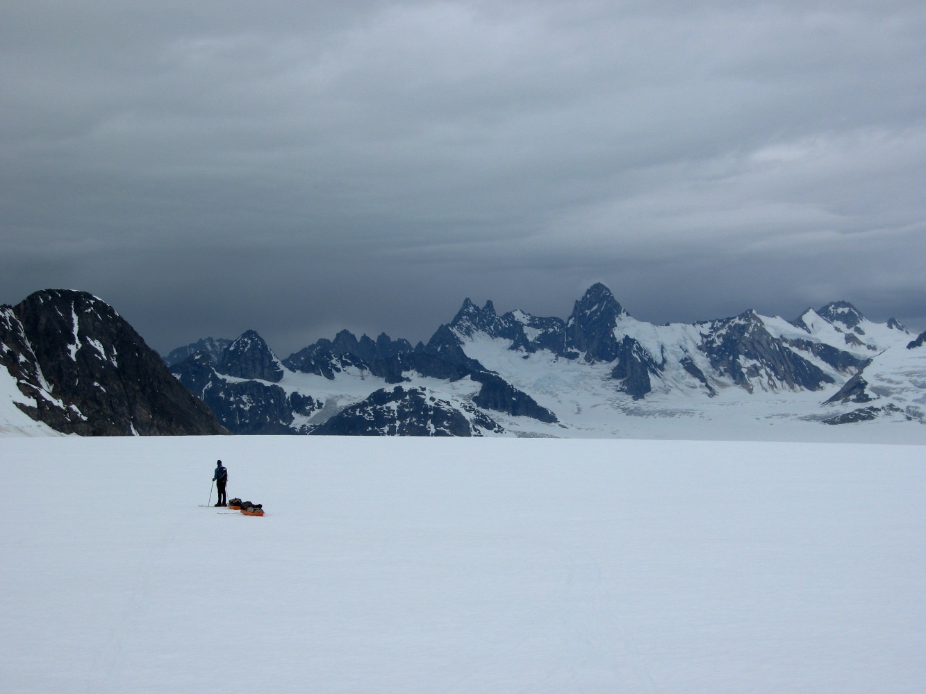
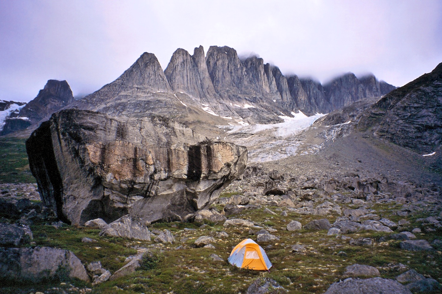
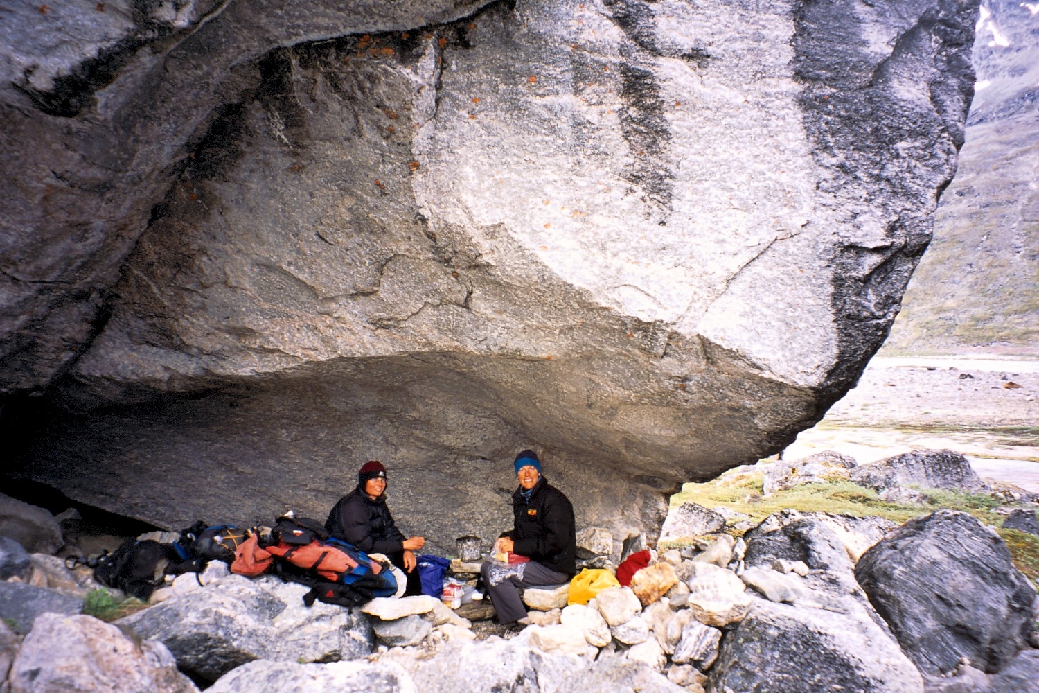
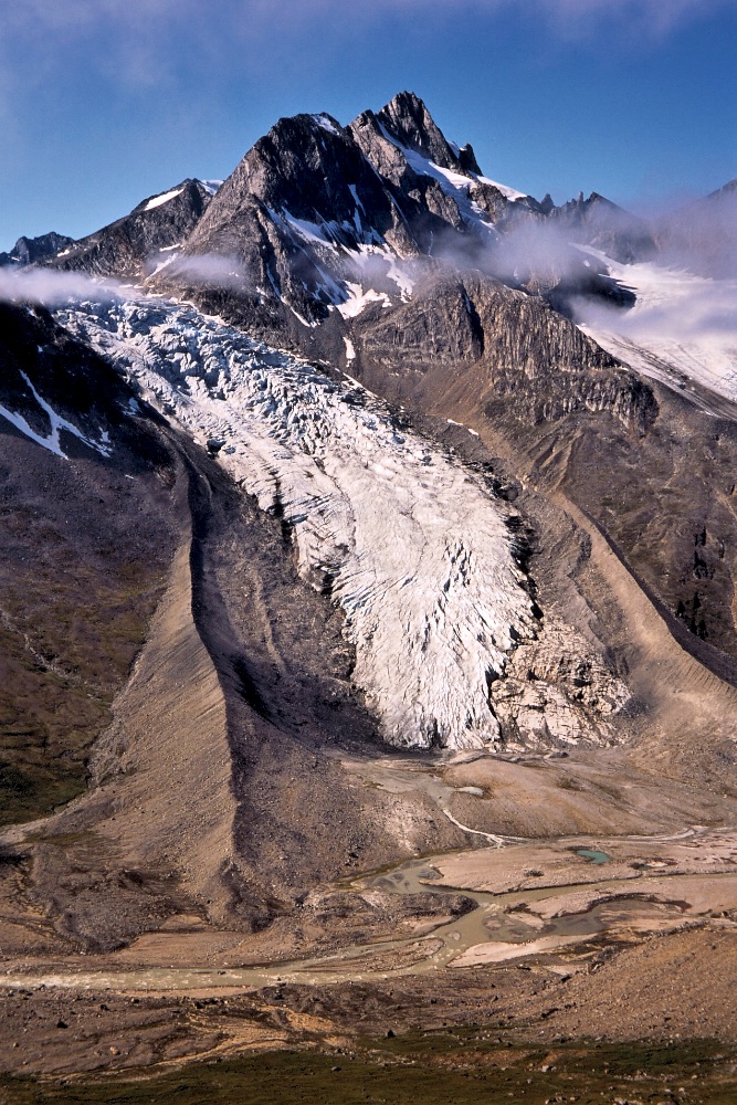
Finally we were on our own with 150kg of gear to ferry up to a mountain hut which we lugged up over three gruelling days. The hut was at the edge of a glacier so we loaded our gear in sleds and skied from there pulling our ‘pulks’. After a full day skiing we'd negotiated a few crevasses and crossed the Kaarali Glacier, and set up camp on the snow. The following day we hiked up a nearby small peak marked 1265m on our map, and noted the good quality gneiss rock which we’d hoped would occur on many of the peaks as it would give good climbing. However we also noted the choosy, crumbly rock which would be best avoided. Another day’s skiing took us to the head of a snow basin where we were surrounded by nice rocky peaks with the Col de Phantome at the end, and we set up camp on a rocky outcrop.
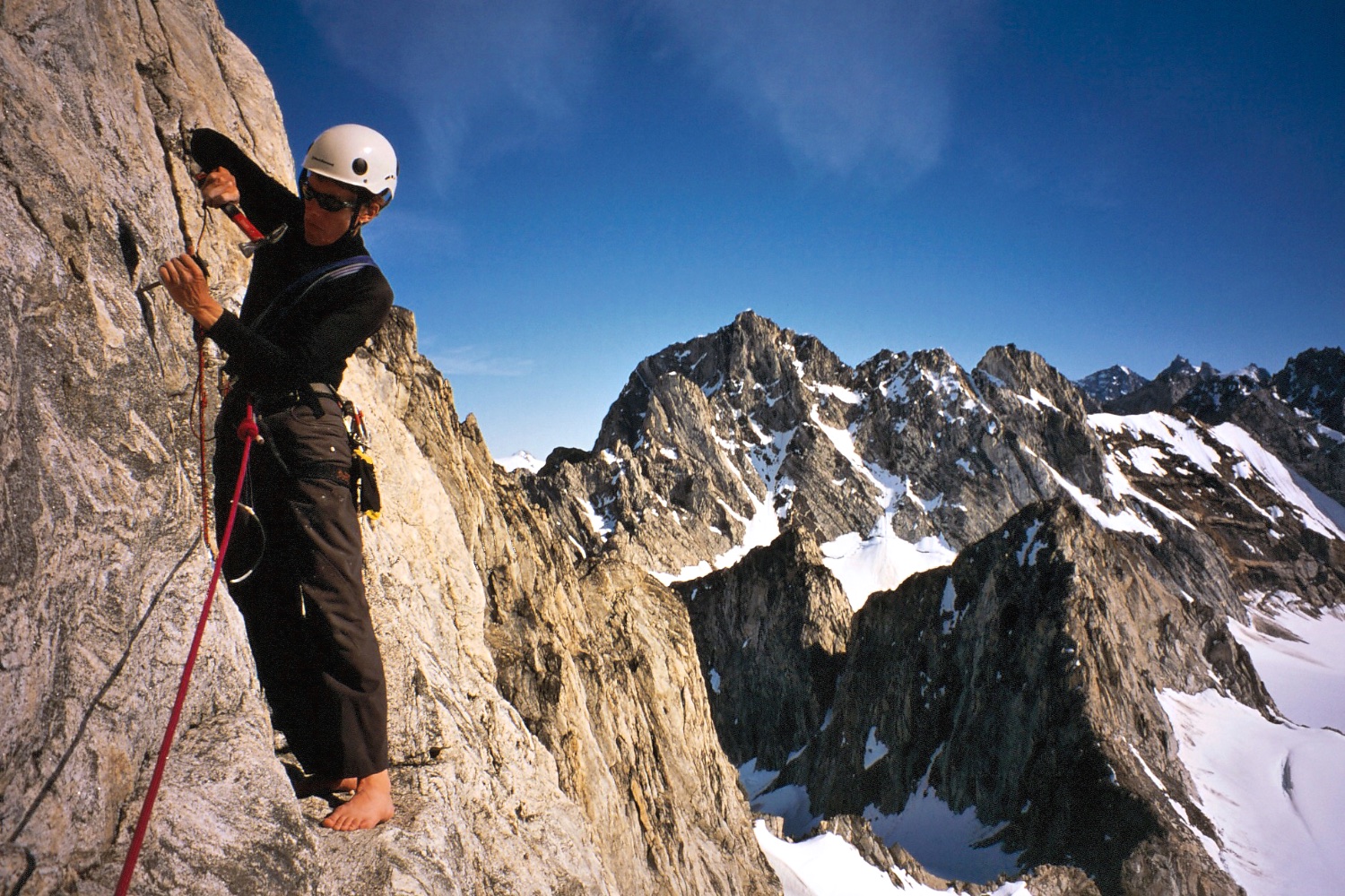
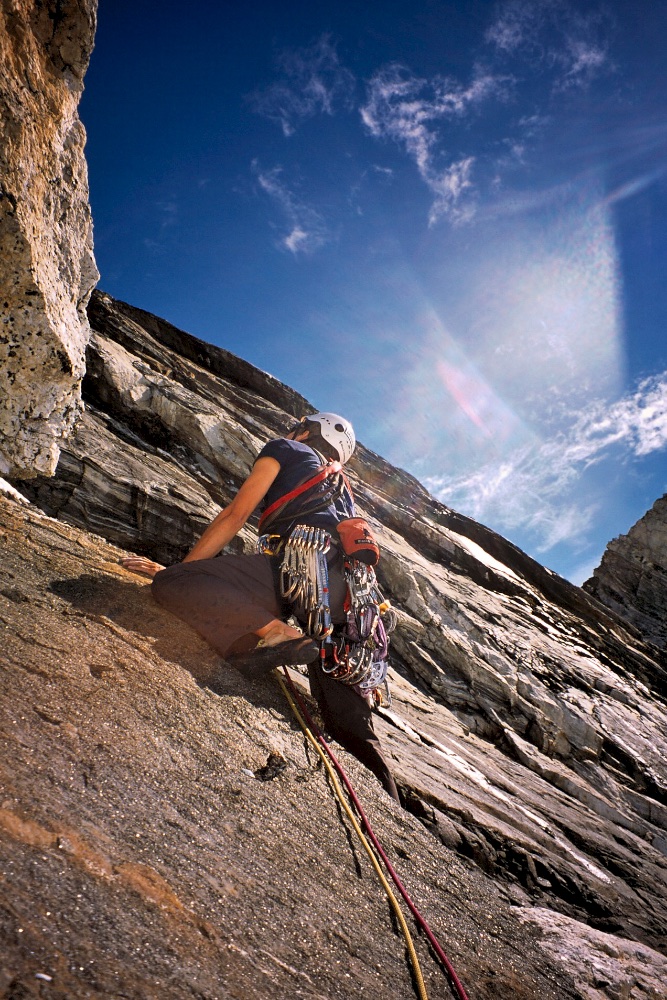
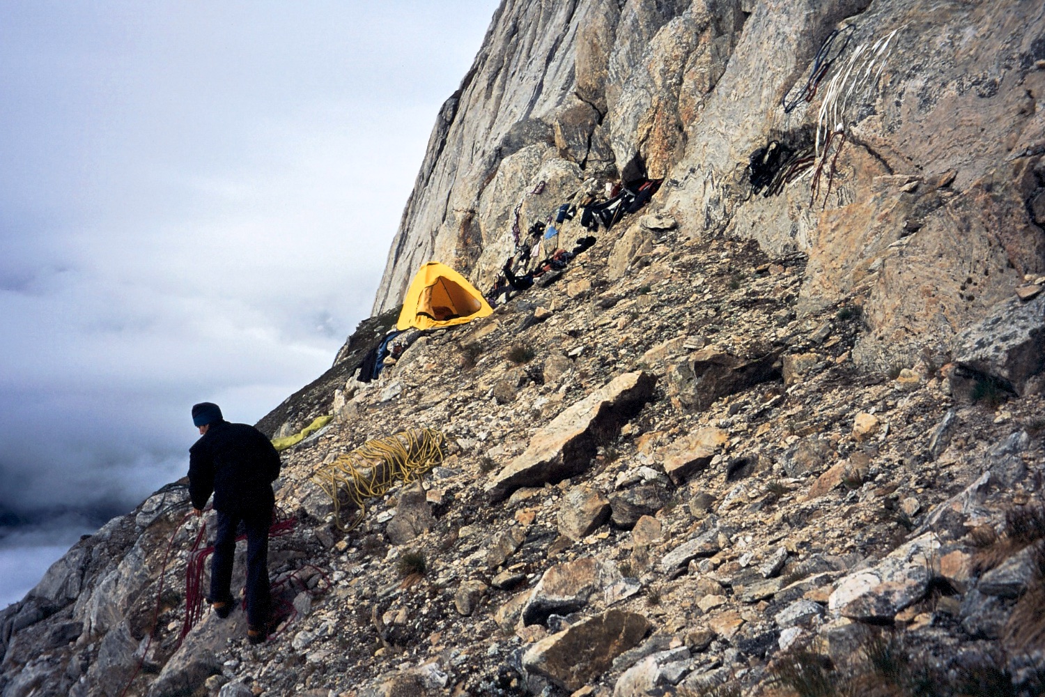
A section of aid on the Monolith, made all the more painful in climbing shoes.
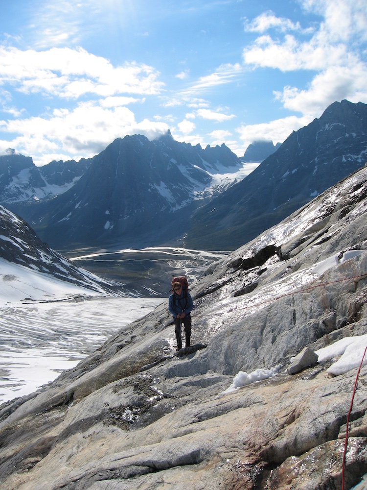
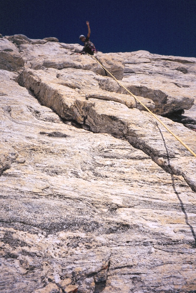
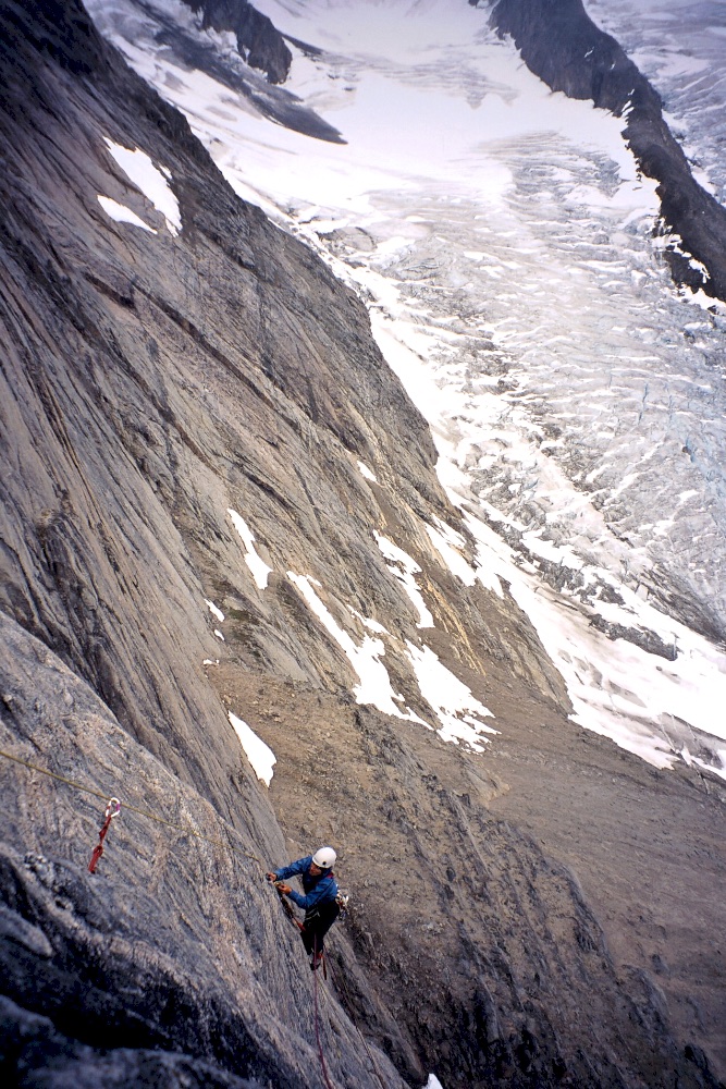
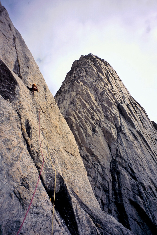
There was an obvious climbing objective which we dubbed the Monolith as this stand-alone peak was like a big vertical shield of rock, so we thought we’d try to climb this first. On our first day climbing the Monolith, we ran out of water quite early in the day - we’d underestimated how hot it could be in the Arctic surrounded by snow! So we left a fixed rope and continued the next day with lots of water! We roughly followed a corner crack which gave great climbing. In some sections we had to revert to aid climbing where it got steep or thin. Generally the rock was good, although there was some loose rock which increased higher up. At 7pm and five pitches we were at a high point where we decided that the options ahead were too loose to be climbed safely, so we hand drilled rappel bolts and abseiled down. It was obviously very disappointing not to get to the very top, especially as the views over into the areas behind our snow basin would have been spectacular. Although we were about 50m shy of the summit, we still named our route ‘Blood, Sweat and Suncream’ and gave it a grade of 19 A2+.
From our camp in the basin, we also attempted to climb a pyramid-shaped rocky peak we dubbed Thylacine due to some big striped rock bands that resembled the striped back of the extinct marsupial. However, this attractive stripy rock was actually the rotten rock, and as the face we were climbing was a slab, there was also an accumulation of sand, loose rock and crumbly bits. After much rock being dislodged whilst climbing and more loose terrain above, we deemed it too dangerous and decided to retreat, which brought down more loose rock when we pulled our ropes on the descent. After that horror show, it made us think that the loose rock near the top of the Monolith was quite solid in comparison so we decided we reclimb our route ‘Blood, Sweat and Suncream’ and attempt to sneak past the loose rock to the very summit.
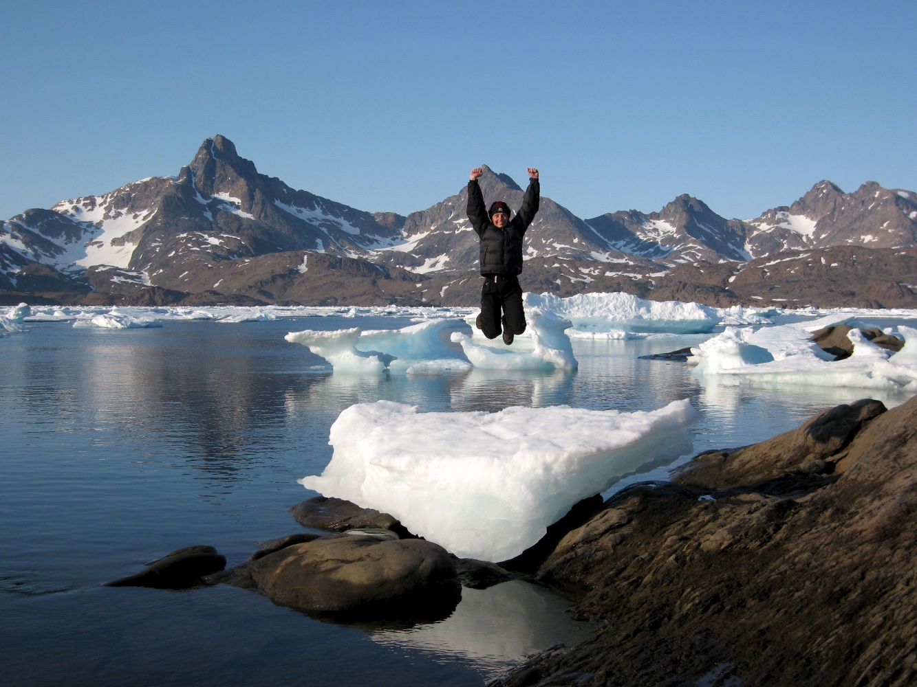
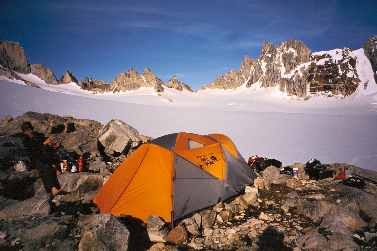
We’d had amazing weather so far, clear sunny days with hardly a breath of wind, and with 24 hour daylight, we had some splendid, albeit hot, days in the snow basin. However our luck with the weather began to run out and we had some rain. The following day after a 3am start, we skied the one hour to the base of the Monolith while the weather looked less than promising. One thing we noticed when we went up the snow slope to the base of the rock wall was that there was an extra 2m of new rock to climb since we first climbed it - all the good weather had melted the snow considerably. As Tash was putting on her rock shoes to start up the first pitch, it started to rain. So that put an end to the climb, and as we’d originally planned to ski back that day, we packed up camp and did an epic ski/sled haul back to the mountain hut. We were pretty tired after such a big day having covered about 22km pulling heavy sleds on top of the ski up and back from the Monolith. A couple of rainy days followed, so we were glad to be in a hut and made the most of washing ourselves and gorging on leftover hut food: several years out of date freeze-dried meals and desserts, coffee, 7 year old peanut butter, but it was all tasty to us. We eventually got all our gear back down to the Tasiilap Kuua Valley and set up a base camp below the Fox Jaw Cirque.
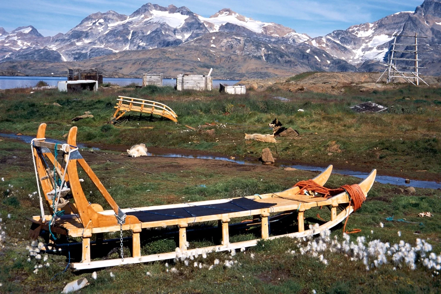
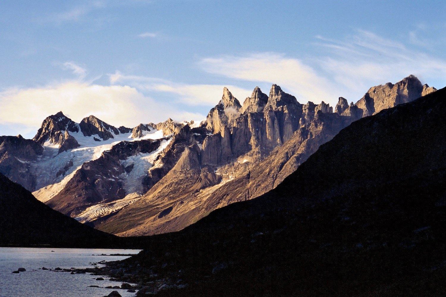
Bivvy camp below the Baby Molar
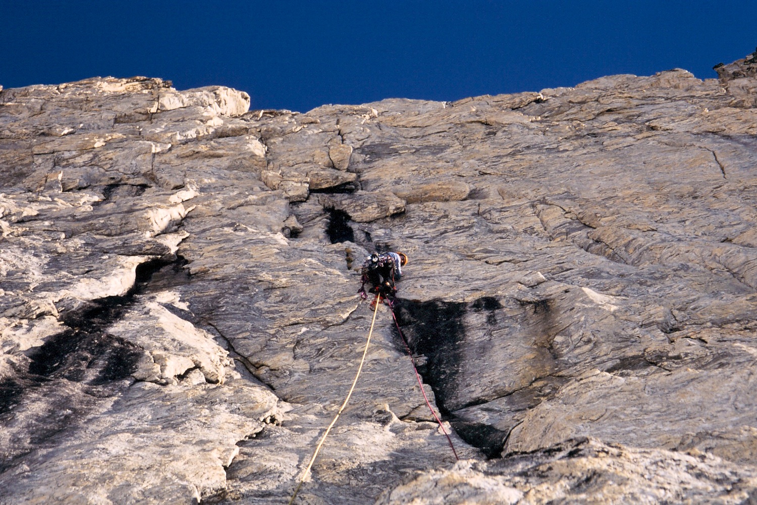
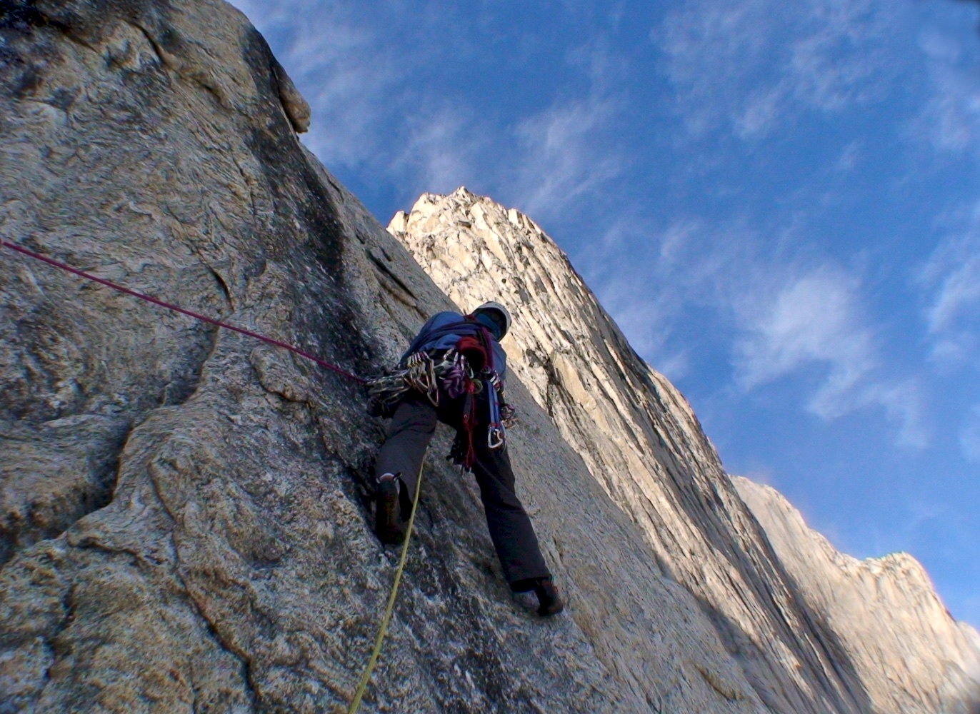
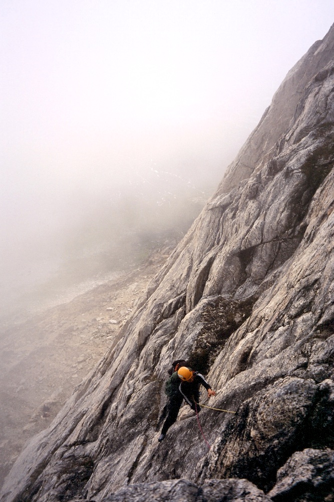
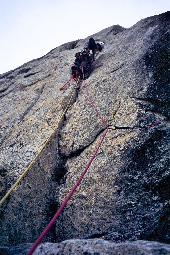
After six days of rain, we got a day of better weather and hiked up with climbing and bivvy gear to the base of one of the nearer rock towers called the Baby Molar. The same day we managed to get in three pitches of a new route on excellent rock, most of it free climbing, but one very thin section of about 10m which was aided. As we had three ropes we fixed them the 150m we'd climbed, so we could continue the climb the next day, and rapped back down to the base. We bivvied overnight at the base and headed up our ropes on the Baby Molar the next day. As Tash climbed the fourth pitch, starting off free climbing but requiring aid for the last two-thirds, ominous, dark clouds were moving closer from down the fjord. By the time Gemma was nearing the top of the fourth pitch, it started raining and then snowing. Although it looked like we’d done the harder climbing and easier terrain lay ahead to the summit, we couldn’t climb wet slabs, so had to drill bolts for an abseil anchor. In the hard rock, this took about an hour, and when we’d finished the anchor, we were wet through and starting to shiver. Fortunately we could sling a boulder for the next abseil anchor, and hammer in some pitons for the third anchor so were much quicker, but the walls had turned to waterfalls and we were very, very cold by the time we crawled into our small bivvy tent.
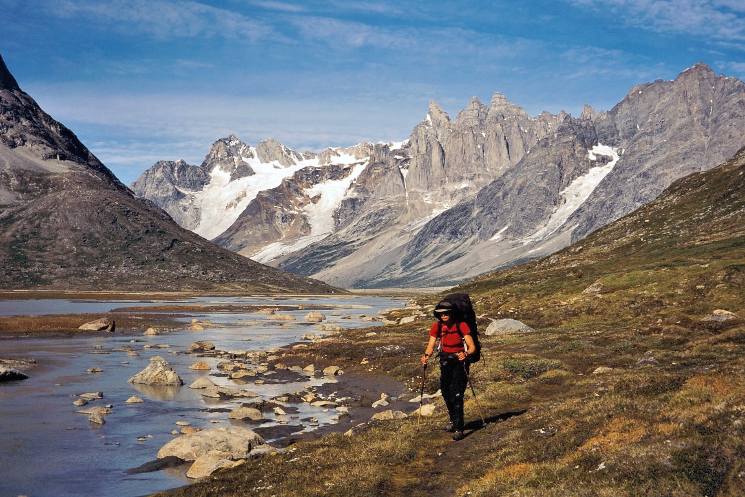
Hiking out from the Fox Jaw Cirque just as the weather improves!
The next day was clearer but as all our gear was soaked - ropes, rock shoes, clothes, everything! - we had to spend the day drying it all out. So as the following day was also not raining, we decided to reclimb our route - there was definitely a pattern to this climbing trip! We were on the rock by 5.30am, and knowing the pitches, we climbed much quicker second time around. The weather was not looking good once again, and as Gemma was on the third pitch aiding through the thin seam, the rain started and she had to down climb, retreating yet again!
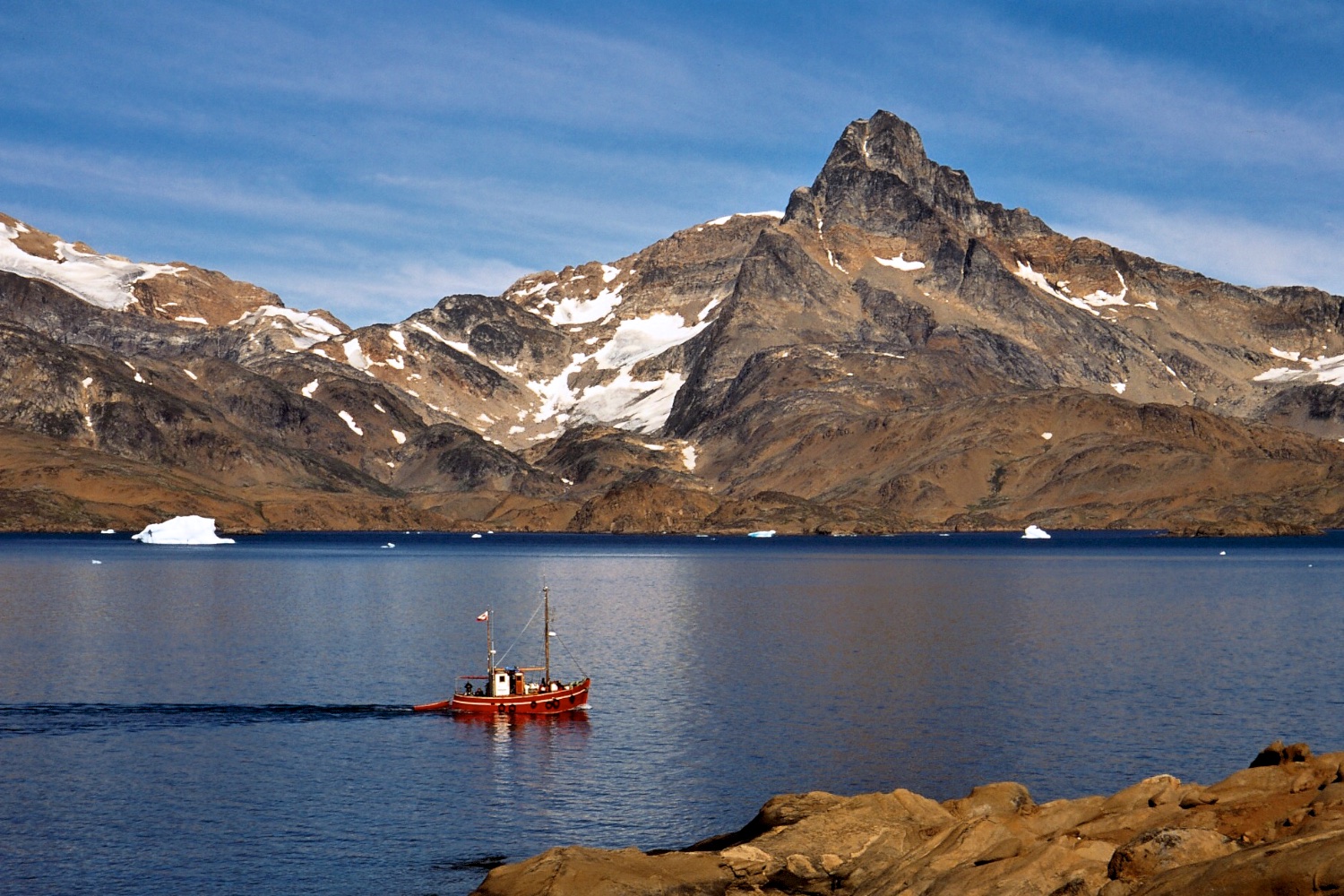
With our time there coming to an end, we had to start carrying our gear out to the Tasiilaq Fjord where a boat was going to pick us up. Of course on our final day hiking out, the weather had cleared and was sunny again - what torture! Unbeknownst to us, our scheduled boat that was coming from Tasiilaq, couldn’t make it out due to strong winds, and yet we were sitting, waiting in perfect calm sunny weather. With our food pretty much gone, the extra day’s wait meant we were catching fish in the fjord, and dinner consisted of two small fish, some instant mashed potato, followed by sugar and jam for dessert!
Facts
Where
Greenland is in the Arctic and is the world's largest island, with most of it covered in permanent ice up to 3km in depth.
Greenland with Tasillaq marked on the south-east coast. (Click on map for larger image)
The town of Tasiilaq is on the south-east coast, lying just below the Arctic Circle at 65°36′49″N 37°37′52″W. The area we climbed was approx. 90km north of Tasiilaq.
The airport in Kulusuk is shown in yellow; the town of Tasiilaq is in red; the fishing village of Kuummiiut is in blue, with the route in by fishing boat shown as a red line. (Click on map for larger image)
The red line shows our hiking route up to the Tasiilaq Fjeldhytte, then by ski across the Kaarali Glacier to camp below the Col de Phantome, then to the Fox Jaw Cirque with that camp shown in green. (Click on map for larger image)
Climbing
‘Blood, Sweat and Suncream’, 19 A2+, 5 pitches/170m (50m short of summit).
Attempted new route of Thylacine Slab, reached 120m (up to grade 18). Retreat due to poor rock.
Attempted new route on Baby Molar, climbed four pitches (~180m, up to grade 18/A2) before retreating in rain.
Supported by

Other Expeditions
Siberia 2015
MALAYSIA 2013
GREENLAND 2012
JORDAN 2011
INDIA 2008
YOSEMITE 2007
BOLIVIA 2001
Other Pages
MEDIA
BLOG